See every site before, during,
and after construction.
From pre-construction planning to immersive post-build walkthroughs - complete site visibility that reduces surprises.
 Construction Start Packages
 Start every project with all teams aligned.
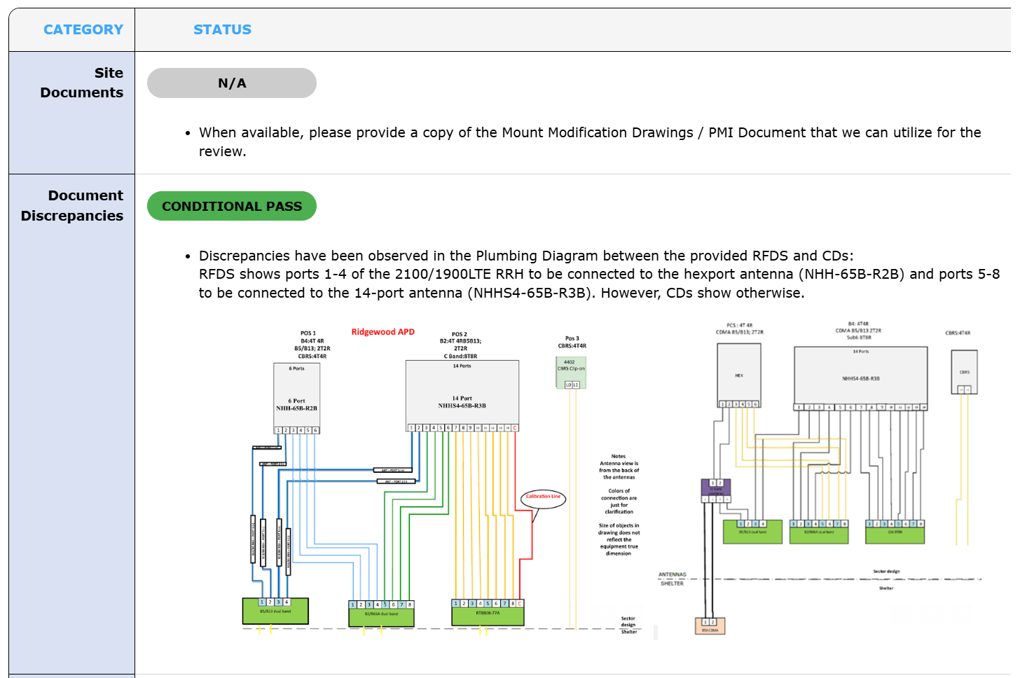
Discrepancies in scope documents and material mismatches don't surface until crews are on site - and by then they're expensive.
- Detailed scope summary with expected values
- Document clash analysis
- Equipment and material validation
- Key contacts and escalation paths
Fewer surprises on day one. Fewer calls asking "which drawing is right?"
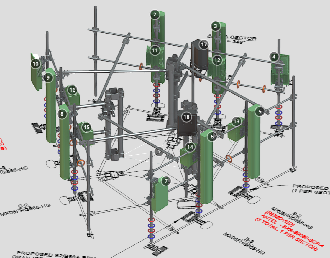
 3D Modeling
 Turn flat drawings into decision-ready models.
Interactive 3D models let engineers, PMs, and crews see exactly what's being built before breaking ground.
- Interactive 3D model from your source documents
- Clash detection and spatial conflict resolution
- Single source of truth for all key values
- Improves comprehension across all stakeholders
Better planning decisions. Clearer communication between office and field.
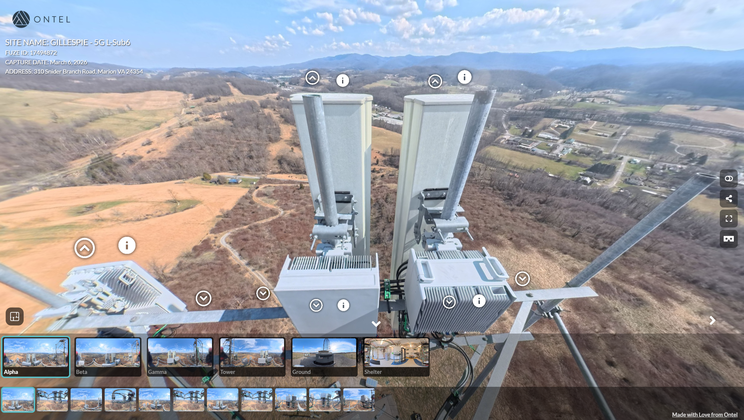
 360° Walkthroughs
 Walk any completed site from your desk.
A single immersive walkthrough of the finished site. Navigate ground level to antenna.
- Immersive 360° tour of the completed installation
- High resolution imagery (72 megapixels)
- Delivered as part of the Final COP
- Reduces photo requirements and field capture time
Fewer site visits. Faster customer acceptance.
 Drone Inspections & Digital Twins
 Inspect any asset without climbing it.
Licensed drone pilots capture aerial data feeding directly into 3D digital twins - trackable over time.
- Aerial data for all site types
- 3D digital twin creation
- Engineering-grade measurement precision
- Change tracking across inspections
Fewer tower climbs. Lower inspection costs. A living digital model of every asset.

See what your sites actually look like.
Request a sample walkthrough, digital twin, or construction start package.
Request a sample →