 Drone Inspections & Digital Twins
 Take your assets
to the next level.
Reduce tower climbs and improve efficiency with accurate models that become the cornerstone for guiding current and future projects - all without a subscription or commitment.
Data you can trust for design and upgrades.
Leverage a national network of pilots and diverse options for analytics with no commitment or subscription fees. Ontel's Drone Inspection and Digital Twins services provide you with the tools necessary to tackle projects in unique environments, collect comprehensive site data, and reduce maintenance costs.
- Aerial data capture for all site-types
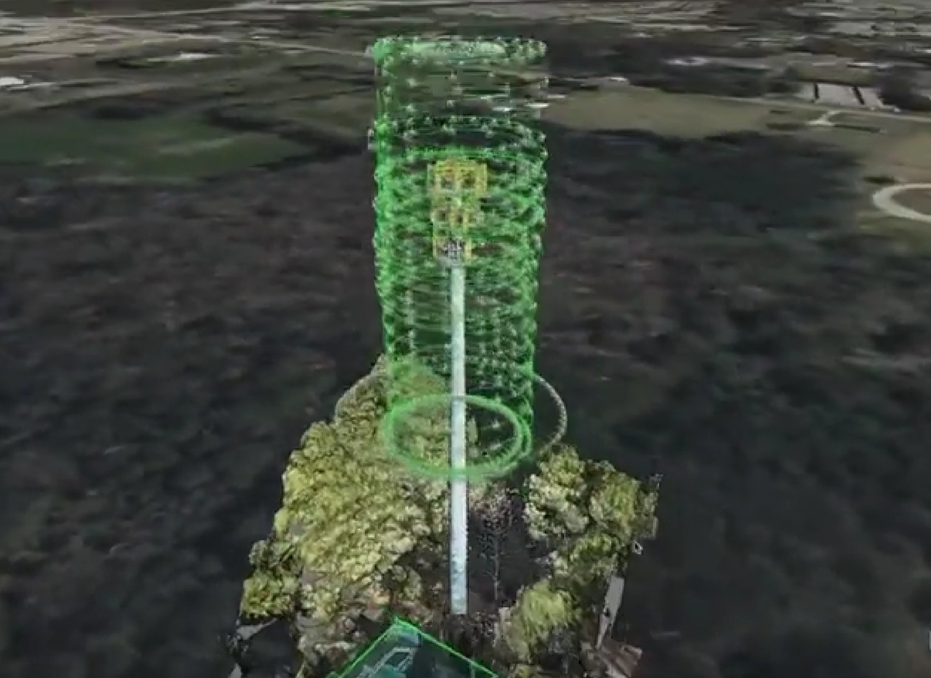
- 3D Digital Twin creation
- Equipment inventory + structural inspections
- Engineering grade precision for all measurements
- Track changes + predict issues over time
- Reduce risk in difficult environments
From flight to report
in days - not weeks.
Automated Flight Paths
Pre-programmed flight paths optimized for full coverage of any site type, from macro towers to rooftops.
48-Hour Turnaround
We target having a drone in the air within 48 hours of construction complete, keeping data current and actionable.
Engineering Grade Precision
Equipment and service-affecting measurements captured with unmatched accuracy on every flight.
Nationwide Pilot Network
Access licensed, experienced pilots across the country — no waiting on availability or sourcing your own crews.
Rapid Data Processing
Aerial data is structured and processed for delivery immediately after capture, minimizing time between flight and report.
No Commitment Required
Deploy on-demand with no subscription fees or high-volume requirements. Scale with your project load.
Reduce risk.
Extend asset lifespan.
Automated Deficiency Detection
Patented algorithms for the identification and classification of potential issues.
Assigned Levels of Severity
Severity status separates critical issues from those that can wait.
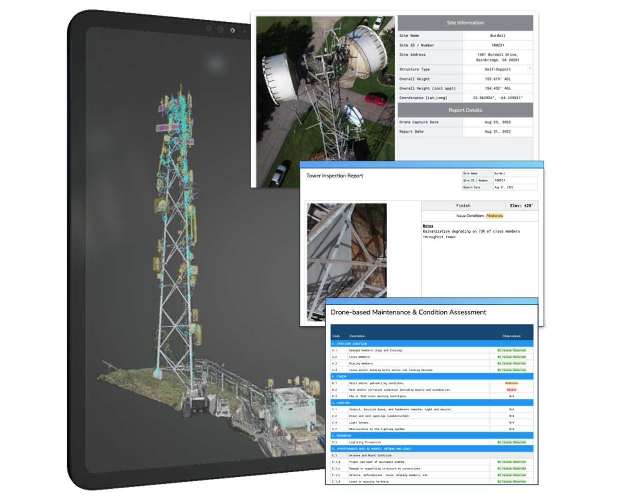
Detailed Tower Inspection Report
Documents all deficiencies including rust, missing bolts, bent structural members, loose cables, and damaged equipment.
Digital Overlay
View deficiency report information as a layer of data in your Digital Twin.
Elevate your insights.
Aerial Data Collection
Access a nationwide network of pilots and state-of-the-art drones without subscription fees or high-volume commitments. Collect high-resolution aerial imagery and geospatial data with low costs and unparalleled precision.
Surveying & Mapping
Topographic surveys, land mapping, and terrain modeling services that provide detailed insights into environmental features and future project locations - invaluable for all phases of design and implementation.
Infrastructure Inspection
Perform remote inspections of infrastructure and towers, cataloging equipment or identifying defects and issues before they become critical, improving safety and reducing maintenance costs.
Virtual Assets
Generate accurate digital twins of physical assets, structures, and environments, enabling real-time simulation and analysis of proposed changes in a virtual space.
Data Integration
Solutions that seamlessly integrate data from photo/video, IoT sensors, and GPS to provide a holistic view of your assets - empowering engineering-grade measurements during project planning.
Predictive Maintenance
Continuously monitor the performance of assets through digital twins and implement strategies that reduce manned tower inspections, minimize downtime, and extend asset lifespan.
Drone Inspections & Digital Twins
Drone inspection and digital twin pricing varies by site type, scope, and volume. Get in touch for a tailored quote - no commitment or subscription required.
To request additional information and pricing for these products & services, please call us or fill out a contact form.
Get a quote →We look forward to hearing from you!
See what a digital twin looks like.
Request a sample inspection report or digital twin from a completed site.
Request a sample →